 The book
Verdwenen Venen. Een onderzoek naar de ligging en exploitatie van thans verdwenen
venen in het gebied tussen Antwerpen, Turnhout, Geertruidenberg en Willemstad
1250 - 1750. Actualisering 2013. was published
in 2013 at Pictures Publishers in Woudrichem, The Netherlands. Yes, indeed,
the 1989 book, but updated with the results of research done in 1985 -
2013, now in colour.
Go to picturespublishers
The book
Verdwenen Venen. Een onderzoek naar de ligging en exploitatie van thans verdwenen
venen in het gebied tussen Antwerpen, Turnhout, Geertruidenberg en Willemstad
1250 - 1750. Actualisering 2013. was published
in 2013 at Pictures Publishers in Woudrichem, The Netherlands. Yes, indeed,
the 1989 book, but updated with the results of research done in 1985 -
2013, now in colour.
Go to picturespublishers
A long text about the medieval
saltproduction asks for your comment or additions! But... only Dutch
text. 1. General Guest Sites:
 On March 26, 2025 has been published at Matrijs in Utrecht, under redaction of prof.dr. Th. Spek:
Landschappen van Nederland. Handboek voor de geschiedenis van onze leefomgeving. This reference book about the history of the Dutch landscapes was realised in coorporation with the Rijksdienst voor het Cultureel Erfgoed and the Kenniscentrum Landschap of the Groningen University. I wrote the chapter about the sandy landscvape in the South of the Netherlands.
Order this book NOW!
On March 26, 2025 has been published at Matrijs in Utrecht, under redaction of prof.dr. Th. Spek:
Landschappen van Nederland. Handboek voor de geschiedenis van onze leefomgeving. This reference book about the history of the Dutch landscapes was realised in coorporation with the Rijksdienst voor het Cultureel Erfgoed and the Kenniscentrum Landschap of the Groningen University. I wrote the chapter about the sandy landscvape in the South of the Netherlands.
Order this book NOW!
 The book Historische Atlas van Breda. has been published at Pictures Publishers in Woudrichem.
The (pre)history of Breda is briefly discussed in 36 chapters, in which maps play an important role.
This concerns both reproductions of old maps and completely new maps for this Atlas.
This Atlas covers the entire present territory of the municipality of Breda in all periods, including the villages and forests.
The Atlas was compiled by four (former) Breda residents: Ton Kappelhof, Karel Leenders, Jan Willem Messer and Paul Klep.
You can order the book here.
The price is 32.50 Euro plus pp.
The book Historische Atlas van Breda. has been published at Pictures Publishers in Woudrichem.
The (pre)history of Breda is briefly discussed in 36 chapters, in which maps play an important role.
This concerns both reproductions of old maps and completely new maps for this Atlas.
This Atlas covers the entire present territory of the municipality of Breda in all periods, including the villages and forests.
The Atlas was compiled by four (former) Breda residents: Ton Kappelhof, Karel Leenders, Jan Willem Messer and Paul Klep.
You can order the book here.
The price is 32.50 Euro plus pp.
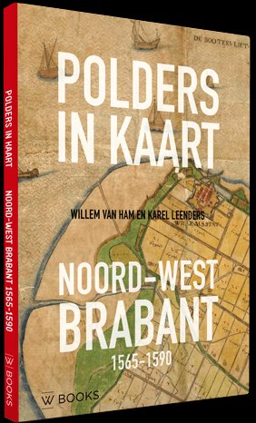 The
book Polders in maps - North-West Brabant
1565-1590 has been published at WBOOKS
in Zwolle on February 21, 2018. This publication has reproductions on paper
(100x100 cm) of the Gastelse Kaart (1565) and the Mauritskaart (1590) with
a detailed and richly illustrated explanation by Willem van Ham and Karel
Leenders. Both maps show in great detail the region between Ooltgensplaat
and Zevenbergen, Strijen and Roosendaal. Be amazed by the amount of water
that still existed, about the progress of the embankments in the intervening
25 years, about the countless details such as bridges, windmills, ferry
boats, villages and fortified towns, but also about a part of the history
of cartography. You can order the book here.
Thanks to subsidies it costs only 12.50 Euro plus pp.
The
book Polders in maps - North-West Brabant
1565-1590 has been published at WBOOKS
in Zwolle on February 21, 2018. This publication has reproductions on paper
(100x100 cm) of the Gastelse Kaart (1565) and the Mauritskaart (1590) with
a detailed and richly illustrated explanation by Willem van Ham and Karel
Leenders. Both maps show in great detail the region between Ooltgensplaat
and Zevenbergen, Strijen and Roosendaal. Be amazed by the amount of water
that still existed, about the progress of the embankments in the intervening
25 years, about the countless details such as bridges, windmills, ferry
boats, villages and fortified towns, but also about a part of the history
of cartography. You can order the book here.
Thanks to subsidies it costs only 12.50 Euro plus pp.
The book De dynamische hoeve. Veranderingen
in boerderijgebouwen en hun omgeving in de Meierij van 's-Hertogenbosch
1662-2015 was published at Pictures Publishers in Woudrichem in 2015.
What now is seen as a typical Brabant farm is a building with brick walls
carrying a roof that is mainly covered with reed with 5 rows of tiles.
On the yard there are few or none outbuildings. The farm of 1662 had a
completely different character. What changed? How, why and when? That is
described in the book De dynamische hoeve (The dynamical farm). You can
order this book here.
It costs 22.50 Euro plus pp.
2. List of publications
3. Texts
4. List of charters
5. Some sites of historical-geographic interest
6. Literature about Brabant history
© Copyright : dr K.A.H.W. Leenders
Version December 26th, 2025.